The Whitsundays are a group of more than 150 islands and islets off the sub-tropical central Queensland coast of Australia between approximately 20° and 21° south latitude.
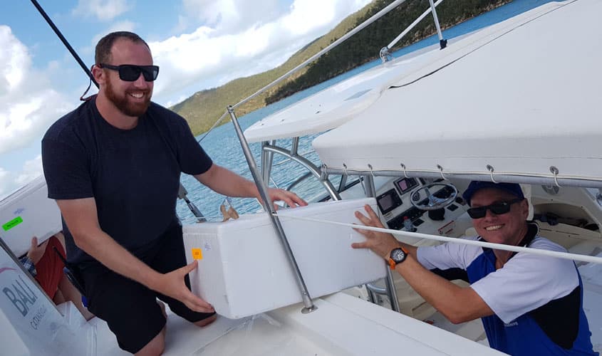
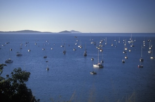
Among the world’s best cruising grounds, the islands offer an abundance of yacht anchorages each within easy sailing distance from the next.
Most of the islands are unspoilt national parks; at this time, five have resorts.
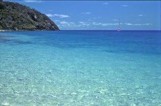
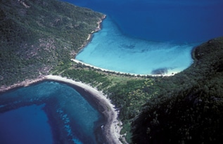
The brilliant turquoise of the waters surrounding the Whitsundays is caused by the scattering of light by particles of fine sediments that come from the river systems of the adjacent mainland.
Huge tides (typically 3–5 metres in rise and fall) that sweep this part of the coast keep these sediments stirred up and scatter the sunlight, in the same way that scattering of light gives the sky its blue colour.
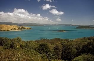
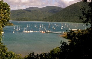
View from Hamilton Island, surveying the vibrant turquoise waters of the Whitsunday Passage
The Whitsundays are a popular destination for holidaymakers of all kinds and for those who just enjoy being on or in the water. The unspoilt nature of the islands makes it possible to feel that one is making a discovery or setting foot where no one has gone before.
The Whitsundays are among the world’s finest cruisng grounds
Discovery and origins
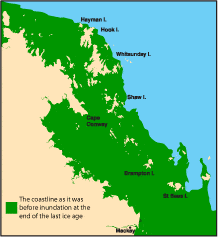
The islands were made known to Europeans by the English explorer, James Cook, in 1770, but Australian aborigines knew all about them at least 6000 years before that and probably for even longer, back to the days before they actually were islands. The Whitsundays are the tops of coastal mountains that became cut off from the mainland during the end of the last ice age. The sea attained its current level about 6000 years ago.
Geology
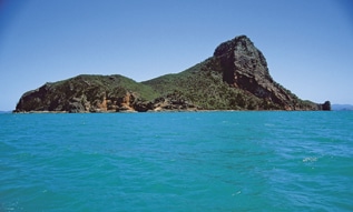
The islands are of the same geological composition as the adjacent mainland. They are cloaked in eucalypt and pine, with the occasional swathe of vivid green grassland or an occasional shadowy gully of rainforest. Patches of exposed granite betray the islands’ essentially rocky character. Being in subtropical waters where corals grow, they are surrounded by fringing coral reefs that give them a jewel-like appearance when viewed from above. These fringing reefs can provide hours of diversion for scuba divers, snorkellers and those who enjoy fishing.
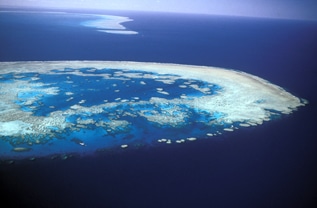
The Whitsunday islands are in warm subtropical waters where corals grow around their shorelines, providing opportunities for snorkelling, diving and fishing.
The islands’ fringing coral reefs impart a jewel-like appearance viewed from the air
Origin of the name ‘Whitsundays’
European discoverer James Cook didn’t name the islands but rather ‘Whitsunday’s Passage’, which was the passage between Cape Conway (20° 22’S, 148° 55’E, the tip of the mainland on the west) and the islands lying to the east of this. That Sunday in June 1770 when he passed through was Whit Sunday, the celebration on the Christian calendar that takes place on the 49th day (7 weeks) after Easter Sunday. The term is derived from Old English meaning “White Sunday”, after the white robes of those newly baptised at Pentecost, the fiftieth day after the second day of the Passover.
Officially they are the ‘Cumberland Islands’
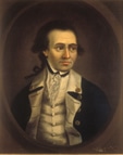
Cook named the surrounding islands ‘Cumberland Isles’, and on his sketch of the area, the label ‘Cumberland Isles’ extends well to the south of Cape Conway and the islands to the east. Cook actually named only one of the islands, Pentecost.
The only island Cook named – Pentecost Island
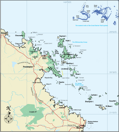
Successive naval surveyors in the 1800s gave names to most of the rest, many names coming from the old county of Cumberland in England (now Cumbria) because the landscape reminded the surveyors of that part of England. Today’s charts show a ‘Whitsunday Group’ (as well as other island groups), but there is no official definition of the ‘Whitsunday islands’. There are over 150 islands, islets and rocks in the Cumberlands, which the hydrographic office considers to be all those from Snare Peak Island in the south (21° 06′ S, 149° 56′ E) to Hayman Island in the north (20° 03 S, 148° 53’E). Someone somewhere along the line in an advertising brochure seized upon the number ’74’ as being the number of ‘Whitsunday islands’, a figure often touted in promotion of the area but which has no apparent basis.
The climate
The Whitsundays have a warm subtropical climate with mild winters and warm to very warm summers. Much of the annual rainfall occurs in the wet season, which is usually January-March, when a considerable portion of rain falls at night. The water is a swimmable temperature year round, and the Queensland sun creates shirt-sleeve weather most of the time.
Whitsunday temperatures and rainfall
Temperatures in degrees Celcius (to convert to approximate Fahrenheit temperatures, double and add 32)
| Jan. | Apr. | July | Oct. | |
| Av. daily high (°C) | 31 | 28 | 23 | 28 |
| Av. daily low (°C) | 25 | 23 | 17 | 21 |
| Days rain (over 0.2 mm) | 13 | 14 | 5 | 5 |
| Normal rainfall (mm) | 203 | 115 | 36 | 16 |
| Mean sea temp. (°C) | 27 | 26 | 22 | 24 |
Normal annual rainfall – 1445 mm
The southern tropics have occasional cyclones, which can occur in the Whitsundays from November to May, but if they happen at all, are most likely to come in February and March. Queensland has an excellent cyclone warning system that provides plenty of advance notice of an impending cyclone.
The Whitsunday mainland
The mainland coast along the spread of the Whitsunday Islands stretches approximately from the town of Mackay in the south (21° 06’S, 149° 14’E (pop. 82,300) to the coastal villages of Airlie Beach, Cannonvale and Shute Harbour in the north (20° 05’S, 148° 32’E). The Whitsunday Shire (total population appx. 20,000) comprises these three villages as well as the resort islands of Hamilton, Hayman and Daydream and the sugar-farming town of Proserpine about 35 minutes inland by car.
Cannonvale was the earliest settlement in this area and continues to be a residential centre with a growing interest in tourism. Three kilometres to the east of Cannonvale is Airlie Beach, Whitsunday’s resort town and business centre, with holiday accommodation, nightlife, restaurants, tourist booking agencies, shops and a growing number of condominiums.
Islands beckon in the distance looking northwards from Airlie Beach
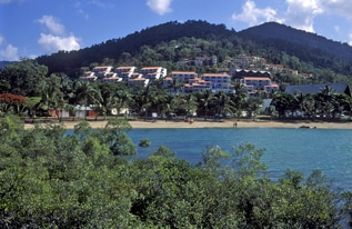
Airlie Beach is the Whitsundays’ resort town and business centre
At Abell Point, a short distance back towards Cannonvale, is the Abell Point Marina (20° 16’S, 148° 43’E), a boating centre and point of embarkation for the islands and the Great Barrier Reef.
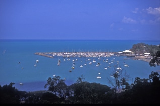
Abell Point Marina is the largest mainland marina in the area and a major point of embarkation for the islands and the Great Barrier Reef
Ten kilometres down the road to the south-east of Airlie is Shute Harbour, the best natural harbour for many kilometres up or down the coast. Historically it was the principal jumping-off point for the islands and many island day trips embark from its jetties.
Shute Harbour is the best natural harbour on this part of the coast and is one of two main embarkation points for the islands
The Great Barrier Reef
The nearest reefs of the Great Barrier system lie 34 nautical miles north-east of the Whitsunday mainland. It’s about a 2.5 hour trip in one of the fast motorised catamarans that take daily excursions to Hardy Reef. Other vessels carrying scuba divers and snorkellers also do regular trips to the Reef.
Bait Reef is the nearest to the Whitsundays of the platform reefs of the Great Barrier Reef proper and is very popular with scuba divers
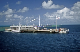
Hardy Reef is the site of a pontoon where visitors can snorkel, dive and sunbake at the Great Barrier Reef
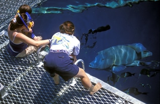
There’s plenty of actiion around the pontoon for the entertainment of young and old
The Cumberland Islands
Get this information and more in the latest edition of 100 Magic Miles of the Great Barrier Reef – The Whitsunday Islands